Craven Herald
21 April 2016
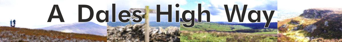
Take the high road in top trail
 Eye
on the Dales
Eye
on the Dales
Rural campaigner Colin Speakman looks at the increasing popularity of
the Dales High Way long-distance footpath
EARLIER this year, the Dales Way Association heard from a group of
walkers from USA who planned walk from Skipton to the Lake District this
summer. They discovered they could do it by using the recently established
Dales High Way long distance footpath, as far as Dentdale, from where they
would join the popular Dales Way to head west from the Lune valley to
Windermere.
The fact that this journey is now possible on foot reflects the growing
network of official and semi-official long distance walking trails now being
developed throughout the North of England including several in the Yorkshire
Dales.
The Dales High Way story is an interesting one. It was the creation of
Tony and Chris Grogan, a unique husband and wife team who are walkers,
writers, photographers, cartographers and publishers. Tony and Chris operate
their specialist publishing company, Skyware Press from their home in
Saltaire.
They first walked and researched the route in 2007 and, in 2008, turned
it into a 90-mile trail, which starts near their home in the World Heritage
village of Saltaire and ends in Appleby, in Cumbria.
It was inspired by the Dales Way which it parallels for much of the way.
But whereas the Dales Way is essentially a riverside walk, A Dales High Way
as its name implies crosses the tops – over Rombalds Moor to Ilkley,
Addingham and Skipton Moors to Skipton, then over Sharp Haw, and Weets Top
into Malham, Kirkby Fell to Settle, Smearsett and Ingleborough to
Ribblehead, Wold End to Dent where it meets the Dales Way, then Longstone
Fell to Sedbergh.
North of Sedbergh the route has new relevance because it provides a
direct link into the northern Howgills and Bowderdale, now the newly
extended area of the Yorkshire Dales National Park, heading to Newbiggin on
Lune, and through the Orton Fells to Great Asby and Hoff to Appleby.
So together with Wainwright’s Coast to Coast, which crosses the new areas
west-to-east, A Dales High Way is a fine south-to-north way of discovering
this stunningly beautiful addition to our national park. If the Dales Way is
ideal for people who are not such strong or experienced walkers, as much of
the route is along relatively gentle valley paths, A Dales High Way is very
much the next stage up, as most of the route follows footpaths across rough
grazing or moorland, with some quite sharp ascents and steep summits to
conquer, but with magnificent views as rich reward.
So A Dales High Way is ideal for people who have done the Dales Way and
now feel they can tackle something a little more ambitious. With plenty of
places to stay in towns and villages along the route, most walkers can walk
it comfortably within a week.
But what the route does have in common with the Dales Way is excellent
public transport access, most particularly the legendary Settle-Carlisle
Line and local stations on the MetroTrain network. So if you don’t want to
backpack and stay overnight you can walk the trail in day stages – though
some are quite long – in time for a late train back to Skipton and West
Yorkshire.
A Dales High Way is now an officially accepted route within the Yorkshire
Dales National Park and in both Bradford and Cumbria. It is marked on
Ordnance Survey maps as a recreational path and the distinctive waymark is
now increasingly used along the route and as a logo in publicity. There is
even a thriving Friends organisation, with its own website,
daleshighway.co.uk, and regular newsletter, that campaigns to secure
improvement to the route, better waymarking and signing and to keep members
informed of changes including accommodation availability.
The definitive guide book, by Chris and Tony, is in two parts – A Dales
High Way Route Guide in essence the detailed maps you need for the route in
rucksack-pocket sized format, and the slightly larger A Dales High Way
Companion which contains a wealth of information about what to see along the
walk – local and natural history, geology, background information, and some
excellent photographs. You can buy both books locally or online direct from
the publishers – skyware.co.uk
Some people grumble that we now have too many walking trails. Not all
proposed routes are of sufficient quality and interest to survive more than
a few years. But A Dales High Way is well-established, providing as it does
such a wonderful, high level, high quality route through Craven and into the
national park, and meeting a different need to the already internationally
known Dales Way.
We now know walking is supremely important activity for human health –
the best possible preventive and curative medicine for a wide range of
conditions, antidote to the sedentary lives most of us lead that causes the
horrors of obesity, heart disease, diabetes, cancers and many other
illnesses. Walkers also spend money, especially when they stay overnight,
and long distance walking now makes a very significant contribution to
tourism businesses in Craven. New routes also mean that trade is spread to
different villages, guest houses, pubs, shops, and their suppliers.
Such economic activity creates jobs, including jobs for younger people,
that help keep the Dales alive. Not the whole answer of course, but by
attracting people not just from nearby conurbations but from all over the
world, the local economy is supported. Thanks to the brilliant work of
Welcome to Yorkshire, the Yorkshire Dales are increasingly recognised as an
international destination for sustainable tourism, of which A Dales High Way
is an outstanding example.
See The Craven Herald
website.
Bradford Telegraph & Argus
Saturday, October 4, 2008
From "Book Of The Week" column by Mike Priestley
... For the more ambitious walkers, Tony and Chris Grogan have devised A
Dales High Way, a 90-miles walk across the high country of the Dales. In
their introduction they describe how the project came about.
"In September, 2007, we set off to walk from our home in Saltaire to
Appleby-in-Westmorland, following ancient trade routes, green lanes and
packhorse trails wherever possible. Each day brought new excitement as we
explored the spectacular landscapes of the high country, until finally, in the
lush Eden Valley, the red sandstone of Appleby Castle came into view...."
Their description of the route makes you want to pull your boots on and set
off immediately.
"It covers some of the most beautiful scenery in the Yorkshire Dales
from the darkly mysterious Rombalds Moor, with its Stone Age rock art, to the
dramatic limestone scars of Malhamdale. It meanders along the banks of the River
Ribble, where in autumn, salmon can be seen leaping up the waterfalls of
Stainforth Force, and passes the isolated splendour of Sunbiggin Tarn. It climbs
mighty Ingleborough and in a breathtaking six-mile ridge walk crosses the
velvety folds of the Howgill Fells." It does all this (or encourages
walkers to do all this) in eight day-long stages, the shortest and first being
7.5 miles and the longest (Chapel-le-Dale to Sedbergh) 15.7 miles. The
geographical and historical points of interest our outlined for each section,
with the route details being covered by the splendidly-detailed maps.
At £6.99 this is an excellently-produced, pocket-sized publication, printed
in full colour on quality paper. It comes in a protective wallet and is
available from local bookshops (including Saltaire bookshop) or via the website
daleshighway.org.uk
See Bradford Telegraph &
Argus website.
The Dalesman
November 2008
A new high way through the Dales
Paul Jackson finds out why a Saltaire couple have decided to devise
their own long-distance walk through Yorkshire
 A
new long-distance walk has been launched to join several others which now
criss-cross Yorkshire. Walks like the Wolds Way, Coast-to-Coast, Cleveland Way,
Dales Way, Ribble Way and a host of others have been established after following
the lead set by the daddy of them all, the Pennine Way.
A
new long-distance walk has been launched to join several others which now
criss-cross Yorkshire. Walks like the Wolds Way, Coast-to-Coast, Cleveland Way,
Dales Way, Ribble Way and a host of others have been established after following
the lead set by the daddy of them all, the Pennine Way.
Now Chris and Tony Grogan have come up with A Dales High Way which starts
from their home town of Saltaire and finishes in Appleby. It roughly follows the
direction of the railway, allowing walkers the bonus of a spectacular ride back
on the Settle-Carlisle.
Chris told me how it all came about: "We've been active walkers for a
number of years and enjoy both days out and longer walking holidays. We've
walked a number of long-distance routes, including the Dales Way and the
Coast-to-Coast path, and we've loved them.
"As we walked we often found ourselves fantasising about our perfect
long distance path. It had to cross the Dales, taking in some of our favourite
bits of this spectacular, interesting and varied landscape. It had to be a high
level route, climbing up into the fells where every day we could look ahead and
get a glimpse of what was still to come. It had to be possible to walk it in a
week and it had to finish with a train ride.
"Eventually we stopped dreaming and started work. We decided to head
north and to follow green lanes, packhorse trails and ancient trade routes
wherever possible. We chose our home village of Saltaire as the starting point
and Appleby in Westmorland on the Settle-Carlisle line, as the finish.
"We love the Settle-Carlisle line. There's a station in Saltaire and we
often use the train to go walking. I grew up next to the line on a hill farm in
Dentdale just below Arten Gill and as a child I always knew it was dinner time
when the 'up' train crossed the viaduct."
The route is approximately ninety miles long and divides naturally into six
sections - Rombalds Moor, Malhamdale, Ingleborough, Dentdale, Howgill Fells and
the Eden Valley. Seasoned walkers might tackle one section each day but most
people might find the first two sections too long and should add a couple of
days.
Tony says: "Once we'd decided the guiding principles behind the walk,
together with the start and finish points, then the general outline fell into
place quite easily. Of course, there are many possible routes between any two
points along the way and we had to walk most of them, but by and large it wasn't
difficult to decide.
"There were, however, a couple of places where we had two alternative
routes and we couldn't decide which to choose. One was the route from Addingham
High Moor over to Skipton. We had one way curving above Silsden and over the top
of Skipton Moor, the other dropping to Addingham and then following the Roman
Road to Skipton. In the end we opted for the latter, and now have no doubts that
it was the right decision, but there are pros and cons for both and it was a
tough task deciding.
"We tried to walk each section at different times of the year, to see
how the route held up under differing weather conditions. As you can imagine,
the last couple of years have been pretty wet, so the route has been well
tested."
 Throughout the time the pair worked on the walk, Tony was also a van driver
for a local bakery, Hughes of Saltaire, who deliver across Yorkshire.
Throughout the time the pair worked on the walk, Tony was also a van driver
for a local bakery, Hughes of Saltaire, who deliver across Yorkshire.
"It meant an early start, 5 to 5.30 each morning," says Tony.
"But I was usually finished by 1pm so I could set off in the afternoon with
the dog and walk sections nearer to Saltaire.
"The train made life much easier. I could leave home and be at
Ribblehead in little over an hour. Further afield we could base ourselves at
Chris's mum's in Dent for a couple of days, or camp overnight at Kirkby Stephen.
"We were checking the final route in detail last September when the Foot
and Mouth outbreak in Surrey occurred. That was a worrying time for everyone and
the restrictions meant that there were more cattle than usual in the fields
across the region. But thankfully the restrictions were lifted just as we set
off to walk the route in its entirety for the first time late in September
2007."
After gaining useful helpand advice from officers from the Yorkshire Dales
National Park, local authorities and fellow walkers, they have produced a handy
guide to the route which includes maps and suggested itineraries and accommodation.
Tony says: "The route guide is intended to be a very practical book and
the colourful and detailed strip maps, inspired in part by Arthur Gemmell's
famous Stile Maps, are its main feature.
"Our next plan is to write A Dales High Way Companion, a book to
accompany the walk which goes into more detail about the culture, history and
geology of this fascinating route. After that we intend to produce a couple of
collections of shorter walks that can be enjoyed in a day or a weekend using the
same style of maps."
Information
The guide, which costs £6.99 (ISBN 9780955998706), is accompanied by a
website www.daleshighway.org.uk. Walkers can share their experiences on the
forum and it is planned to run regular news stories. The guide comes in a handy
waterproof wallet and can be bought direct from the authors at Skyware Ltd, 48
Albert Avenue, Saltaire BD18 4NT, via the website or from tourist information
centres and shops along the route.
See The Dalesman website.
The Westmorland Gazette
November 28, 2008
90 miles of sheer delight among the Dales, by Ann Clarke
A Dales High Way, by Tony & Chris Grogan. Skyware Ltd, £6.99 ISBN
978-0-9559987-0-6
For those who love long-distance walking, this new 90-mile route from
Saltaire, near Shipley, to Appleby will be a delight. Taking in some of the
glorious high country of the Yorkshire Dales, exploring its rich history,
geology and culture, this pocket-sized guide divides the route into six sections
with detailed maps and text to help you follow the way. The authors suggest the
return journey should be by train along the stunning Settle-Carlisle Railway and
I can think of no better way to end this spectacular walk.
See The Westmorland Gazette
website.
STRIDER - Journal of the Long Distance
Walkers Association
November 2008, 112
BOOK REVIEW by Jay Dingley
A DALES HIGH WAY By Tony & Chris Grogan, Skyware Press
ISBN 978-0-9559987-0-6 56pp 2008 £6.99
DO NOT be confused by the title of this book - it is not another book about
the Dales Way. This is a guide to a new 90 mile high level route between
Saltaire in West Yorkshire and Appleby-in-Westmorland. This pocket sized book
contains many interesting photographs and informative descriptions of the
history, geology and the culture of the area - worth buying for these alone.
The route descriptions divide the walk into six sections. The first part is
over the gritstone, peat covered Rombalds Moor, which lies between Airedale and
Wharfedale. Ancient tracks lead the walker to Skipton from where the route
traverses Malhamdale with its spectacular limestone scenery.. After Settle, the
route climbs over Ingleborough (of three peaks fame) to Chapel le Dale and then
follows an ancient packhorse route via Dent to Sedbergh passing Ribblehead
viaduct and Whernside (an alternative over the top of Whernside is given). The
route then crosses the entire range of the Howgill Fells to Newbiggin-on-Lune,
then via the Eden Valley to Appleby-in-Westmorland.
A small scale map plus several larger scale, well-annotated maps form the
route description. These are comprehensive and appear easy to follow but OL2 and
OL19 would be worth carrying for walkers who like the bigger picture.
The walk itself is divided into eight days, ranging from 7.5 miles to 15.7
miles so combining two sections is a possibility. However, the authors suggest
detours so it is well worth studying these options before rushing from start to
finish. The route descriptions suggest diversions in the case of bad weather -
bad weather in England! surely not!! Accommodation is not listed in the book but
detailed lists are available on the official web site.
This looks like an interesting walk linking areas which many members may have
walked. For those of you who enjoy linear walks but hate the problem of finding
your way back to the start, the authors recommend returning to Saltaire on the
Settle - Carlisle railway. An excellent idea and what a brilliant opportunity to
sit back and admire the scenery you have just walked through.
See Long Distance Walkers Association
website.
West Riding Rambler
January 2009
BOOK REVIEW by Keith Wadd
A Dales High Way
A Dales High Way is the name of a brand new long distance walk from Saltaire
to Appleby. The 93 mile walk devised by Chris and Tony Grogan who live at
Saltaire follows ancient trade routes, green lanes and pack horse trails as well
as many footpaths. It conveniently divides into 8 sections, linking Saltaire,
Ilkley, Skipton, Malham, Stainforth, Chapel-le-Dale, Sedbergh, Newbiggin-on-Lune
before finishing in the attractive town of Appleby. The return to West Yorkshire
is of course by means of the Settle to Carlisle railway.
"A Dales High Way" really is a high way in many places, and goes
over Rombalds Moor, Skipton Moor, Sharp Haw, Weets Top, Ingleborough, Whernside
(optional) and the Howgills.
Designed to fit snugly into the walker's pocket "A Dales High Way Route
Guide" describes the route in detail. It contains large-scale coloured maps
for every two to four miles of the route, and these are full of detailed helpful
directions. Alongside the maps is a succinct, knowledgeable commentary on places
of geological or historical interest met on the way. There are also many
attractive photographs. The route guide retails at £6.99, and is on sale via
the website www.daleshighway.org.uk
See The West Riding Ramblers
website.
Friends of the Settle-Carlisle Line
Magazine,
February 2009
Book Review by Peter G. Davies
"A Dales High Way" by Tony and Chris Grogan - Saltaire to
Appleby
This route is different from other walks following the course of the
Settle-Carlisle railway. The route begins in the historic village of Saltaire,
founded by the Victorian Philanthropist Sir Titus Salt, and crosses Ilkley Moor
towards Ilkley before joining part of a prehistoric track, called 'Rombalds Way'
by the historian E.T. Cowling. This route is followed to Skipton. A very long
first day of 17.9 miles which could be broken overnight in Ilkley for walkers
not resident in West Yorkshire.
From Skipton, the route enters the Yorkshire Dales National Park with a climb
over Sharp Haw, before continuing to the village of Hetton. Maintaining height
with extensive views, the route continues towards the fascinating limestone
country of Malham passing with a short diversion to Gordale Scar, and continuing
towards Malham Cove.
The route then follows Stockdale Lane via Nappa Cross to Settle where it
joins the Settle and Carlisle railway. From Settle, the route is over Smearset
Scar to the village of Feizor and the delightful valley of Crumackdale. The
gentle limestone country is then left behind for a stiff climb over Ingleborough,
followed by a steep descent into Chapel-le-Dale. This gives an opportunity to
visit St. Leonard's Church to see the graves of the workforce who constructed
the Ribblehead Viaduct and Blea Moor Tunnel. Day walkers can enjoy a walk along
the ridge over Simon and Park Fells to Ribblehead for the train journey home. An
alternative route is offered, should the weather be inclement, for the climb
over Ingleborough.
There is then an optional climb over Whernside, otherwise walkers follow the
Craven Way over the shoulder of Whernside to enjoy the stunning beauty of
Dentdale and the delightful village of Dent. The route continues of Frostrow
Fell to Sedbergh, before embarking on a traverse of the green velvety Howgill
Fells to Newbiggin-on-Lune. A low level alternative route is given for this
section of the walk if inclement weather should be experienced on the Howgill
Fells.
Limestone country is once again reached between Newbiggin-on-Lune and Appleby
where the verdant Eden Valley is reached.
An excellent and innovative route which is to be highly recommended for
dedicated fell walkers - my feet are itching to get started on this walk! The
book is beautifully illustrated with photographs of points of interest along the
route. As far as Dent Dale it should be possible to do the walk in day stages
from West Yorkshire, making use of the rail services; however, between Dent and
Appleby, accommodation will have to be found. This is readily available on the
website: www.daleshighway.org.uk
The publication is in a useful plastic wallet to keep it dry in wet
conditions and the route is clearly shown in the form of a strip map with the
route directions printed on it. You do however need to take the relevant
Ordnance Survey maps with you.
Available from the FoSCL shops at Settle and Appleby, via the website:
www.daleshighway.org.uk Or by mail order from: Skyware Ltd, 48 Albert Ave.,
Saltaire BD18 4NT. Cost £6.99 + £1.00 p&p.
See Friends of
the Settle Carlisle Line online.
Yorkshire Post
Saturday March 21 2009
Head for the hills and explore the region's highlights
Yorkshire is criss-crossed by some of the best-known walking routes in
Britain and now there is a new addition to the list. Roger Ratcliffe reports.
People who devise long-distance footpaths usually have a very obvious start
and finish to their routes. The Pennine Way, for example, is a 270-mile walk
from one end of England's backbone to the other, while Alfred Wainwright's Coast
to Coast route links the Irish Sea with the North Sea.
For husband and wife Tony and Chris Grogan, however, their objective was
rather more loosely defined. They wanted to be able to leave their front door in
the famous Victorian mill village of Saltaire, near Bradford, and walk
northwards using mostly the highest  ground
they could find until the landscape began to flatten out.
ground
they could find until the landscape began to flatten out.
And when they decided it was time for home, they wanted to make the return
journey via the Settle-Carlisle railway line and its southern extension back to
Saltaire station.
Which is how they gave birth to the idea of their "A Dales High
Way", a new walking route on existing public rights of way that begins in
streets which are the epitome of industrial West Yorkshire and ends at the
market town of Appleby in Cumbria's picturesque Eden Valley.
The Grogans have described, mapped out and illustrated their walk in a new
56-page guidebook. And as seasoned long-distance walkers they had it printed in
what they regard as their perfect guidebook format measuring just 21cm tall by
10 cm wide, contained in a weatherproof slipcase which fits neatly into most
pockets to make it readily available for checking.
"Our walk was not originally intended as a book," says Chris.
"We'd done quite a few of the official long-distance walks but this one was
something we just thought we'd try, linking the bits of the Yorkshire Dales we
loved best.
"When we walked the Dales Way from Ilkley to Bowness-on-Windermere a few
years back we found a lot of it kept to the riverbanks in Wharfedale and
Dentdale and we kept looking up at the tops thinking: 'Hmmmm, we'd really love
to be up there.'"
Describing themselves as "enthusiastic fellwalkers but definitely not
mountaineers", they set about devising their own route through the Dales
that would, as much as possible, stick to the National Park's higher
ground.
To that end, within half an hour of the starting point at Sir Titus Salt's
model village of Saltaire the route climbs through woods at Shipley Glen to
reach the southern flanks of the long whaleback of Rombalds Moor that eventually
becomes the more celebrated Ilkley Moor.
Although an "escape route" is suggested for overnighting in Ilkley,
the route continues west on the moor and keeps to higher ground on Skipton Moor
before crossing into the National Park and traversing Malham Moor.
After taking in the 2,373ft summit of Ingleborough - one of the famous Three
Peaks and highest point reached on the walk - the footpath rounds the shoulder
of Whernside on an old drovers' route known as the Craven Way to take walkers
down into Dentdale. It then crosses Longstone Fell to the town of Sedbergh and
finishes with a 24-mile traverse of the Howgill Fells.
Whilst most of the route is high-level walking, the Grogans resisted the
temptation to aim for every summit they could find, preferring the tops of
Penyghent and Whernside to remain "tantalizing".
Says Tony: "We did think about bringing in all Three Peaks but we didn't
want a walk that picked off all the obvious targets. Anybody can come back and
climb Penyghent, or even make a detour."
Tony produced the book himself on his PC, and illustrated it with his
photographs and maps. As a partner to the book he has also set up a website to
provide prospective walkers with all the information they need to know, from
where to find a room for the night to news of special events taking place along
the route. The site is frequently updated.
Well over 1000 long-distance walks - routes of more than 20 miles in length -
have been established in Britain since the Pennine Way from Edale in the Peak
District to Kirk Yetholm in the Scottish Borders opened in 1965. Some like the
Pennine Way, the Cleveland Way and the Yorkshire Wolds Way have been given
official recognition as "National Trails." Others such as the Coast to
Coast have the lesser designation of "Recreational Path."
"We're not bothered about our walk receiving official blessing,"
Tony says. "We'll be quite happy for people to use the route and enjoy
it."
They are intending to walk the Yorkshire Wolds Way this summer, but will also
be back walking stretches of the Dales High Way. "There are some bits of it
I really love," Chris says.
"There's the point at Weets Top, beyond Hetton, when you move from
moorland scenery to limestone country and on a clear day when the sun is shining
on the limestone it's absolutely stunning. I remember doing it one evening and
the sun was starting to set, and everything looked absolutely
glorious."
A Dales High Way Companion is currently being written, or as Chris
puts it "the book you take to pub after a hard day's slog." It gives
more background to the route, covering things like archaeology, wildlife,
history and culture.
Dales High Way (panel)
The authors have split the 90-mile route into eight lengths, giving time for
exploration of local villages and features along the way.
Day 1: Saltaire to Ilkley (7.5 miles)
Day 2: Ilkley to Skipton (11.4 miles)
Day 3: Skipton to Malham (12.9 miles)
Day 4: Malham to Stainforth (10.3 miles)
Day 5: Stainforth to Chapel-le-Dale (11.6 miles)
Day 6: Chapel-le-Dale to Sedbergh (15.7 miles)
Day 7: Sedbergh to Newbiggin-on-Lune (10.9 miles)
Day 8: Newbiggin-on-Lune to Appleby (12.7 miles)
A Dales High Way by Tony and Chris Grogan is published by Skyware Ltd., price
£6.99. The book can be ordered online at www.skyware.co.uk. To order from the
Yorkshire Post Bookshop, call free on 0800 0153232 or go online at
www.yorkshirepostbookshop.co.uk . Postage and packing Is £2.75. Full details of
the route and accommodation options can be found on www.daleshighway.org.uk
See The Yorkshire Post website
Bradford Telegraph & Argus
Saturday, September 26, 2009
"Book Of The Week" by Jim Greenhalf
HIGH ROAD'S GOOD FRIEND
The Dales walking 'pal' that is well worth taking along in your backpack
A Dales High Way Companion by Tony and Chris Grogan
Skyware Ltd. £9.99
Tony Grogan is better known to me as the intrepid author of The Pickles
Papers and an occasional state-of-Bradford publication in the late 1980s called
Knee Deep In S..t.
His last outing in print about a year ago, A Dales High Way; Route Guide,
passed me by - unlike his latest, A Dales High Way Companion, compiled and
written with his wife Chris.
If you fancy hiking the 93 miles from Saltaire to Appleby-in-Westmorland,
Cumbria, this beautifully designed and illustrated book would indeed be an ideal
companion to have in the back-pack.
It's just the kind of book for people like me who can't tell the difference
between maidenhair spleenwort and Jacob's ladder, a skylark and meadow pipit,
for it includes local history, geology, flora and fauna, route maps and
photographs.
The six sections cover the ground from Saltaire to Skipton; Skipton to
Settle; Settle to Chapel-le-Dale Hill Inn; Hill Inn to Sedbergh; Sedbergh to
Newbiggin-on-Lune; and Newbiggin to journey's end at Appleby.
Tony and Chris, who first walked the route in 2007, calculate that the
journey can be done in eight days, and include diversions into Ilkley, Malham
and Stainforth. The longest stretch, Chapel-le-Dale to Sedbergh, is 15.7 miles.
This is a fireside companion of a book. Looking through, it is easy to
imagine a group of tired walkers who have just followed the red route from
Skipton to Settle recuperating after dinner over a drink, looking through the
page about the Romans in Brigantia.
Although that might sound like the name of a shopping mall, it was a powerful
northern kingdom ruled over by Queen Cartimandua and her husband Venutius. She
sided with the Romans. He went the other way. Such is marriage.
If you want to know what happened next - if you're not online or in
possession of the Encyclopedia Britannica - you'll have to acquire a copy of the
Grogans' book.
Tony advises walkers to book in advance.
He said: "We have a website that supports the book, which has an
accommodation guide along the way - B&Bs, prices and contact numbers.
"Some of the places don't have a lot of accommodation, so you'll have to
book in advance - Chapel-le-Dale in particular.
"There is a company called Brigantes. They will transfer your baggage
from place to place so that you only go with a light day pack. They charge
something like £8 a bag. They will also book all your accommodation as well,
but you pay extra for that. You can find their address on our website as
well."
More than 1,000 copies of the Grogans' first guide have been sold. Another
2,000 copies of the new book have been published. With the tourist body Welcome
To Yorkshire spending millions publicising the delights of Yorkshire throughout
the world, this book may well sell faster than its predecessor.
The book's well worth the cover price. Even if you don't actually walk the
walk, you can sit at home and do it in your head.
A Dales High Way Companion can be bought online via daleshighway.org.uk,
from bookshops, or by post from Skyware Ltd, 48 Albert Avenue, Saltaire, Shipley
BD18 4NT, at £9.99 plus £1 for postage and packing.
See Bradford Telegraph &
Argus website.
The Westmorland Gazette
Wednesday 7th October 2009
Review by Mike Addison
Dales High Way Companion, Tony & Chris Grogan, Skyware £9.99
THIS book covers the route of a new, long distance walk covering 90 miles
from Saltaire in West Yorkshire to Appleby-in-Westmorland.
It is the perfect companion for a tough trek that visits Ingleborough, the
Howgills, Dentdale and the Eden Valley.
There are some wonderful photographs and the book also explores the geology,
history, culture and wildlife of the places visited.
I cannot recommend this guide highly enough.
Friends of the Settle-Carlisle Line
Magazine,
November 2009
Review by Pete Shaw
"A Dales High Way Companion" by Tony and Chris Grogan
This book of 112 pages contains a tour along the Dales High Way, a 90 mile
long distance walk from Saltaire, in West Yorkshire, to Appleby, in Cumbria.
FoSCL members Tony and Chris published 'A Dales High Way' last year which was a
route guide. This new book is a more in-depth look at the landscape, geology,
scenery, towns and villages en route, plus botany and zoology.. It is meant to
do as its title suggests - be a companion book to the original guide, a purpose
it will serve very well, but I found it to be an excellent stand-alone read too.
Well written text, maps and drawings - copiously illustrated with black + white
and colour photographs, it would make a fine present for you, or a friend.
Thoroughly recommended and available from the FoSCL Christmas Sales Department
at £9.99 plus p+p £1.70.
See Friends of
the Settle Carlisle Line online.
The Dales Way Association newsletter
Autumn 2009
DALES HIGH WAY by Steve Taylor
The hardier souls amongst you may wish to attempt the Dales High Way, a walk
that has just been brought to my attention, a 90-mile high-level route between
Saltaire (on the DW Bradford-Ilkley link) and Appleby-in-Westmorland.
The walk takes in Rombalds Moor, Skipton, Malhamdale, Settle, Chapel-le-Dale,
Ingleborough, Ribblehead, Whernside, then follows an ancient packhorse route to
Dent, Sedbergh and over the Howgills to Newbiggin-on-Lune and along the Eden
Valley to Appleby-in-Westmorland. There are low-level alternatives for the
higher sections.
The walk is divided into eight days with sections ranging from 7 ½ miles to
15 ½ miles although two sections can be combined. It comprises 14,000 feet of
ascent.
Due to its popularity, the route is now supported by Brigantes - the baggage
couriers. Details of this firm may be found in the DW handbook.
It is so popular that if you hit on the Long Distance Walkers' Association
website you will see that there is a tracklog with, wait for it, 10-digit GPS
derived grid references that you can download into your hand-held devices
although Chris believes that there is a small charge.
However, more knowledgeable heads than mine say that whereas the DHW cannot
be said to follow the path of the DW (even though at a greater altitude) it is
nevertheless an extremely good and challenging walk in its own right. By taking
in, as it does, Malhamdale and elsewhere it is clear that the DW route is not
strictly followed. So if one of ye taks the high road and one taks the low road
don't expect to meet up in Bowness coz you won't. (please excuse my Scots
accent) I am informed that the only thing that the DW and DHW have in common is
the word 'Dales' in the title and that it is somewhat more strenuous than the DW
but I am assured that you will enjoy it all the same. Once my chipped fingernail
heals I may join you.
For those who are interested a guide, A Dales High Way: Route Guide,
by Tony & Chris Grogan, is available for £6.99 (56pp) from Skyware Ltd., 48
Albert Avenue, Shipley, West Yorkshire. BD18 4NT. ISBN 978-0-9559987-0-6. It
contains information on the history, geology, culture etc. of the Dales High Way
corridor. Similar to our esteemed Chair's book but with altitude (get it
-attitude/altitude). Oh why do I bother? Funny, that's what a lot of you ask me.
I am pleased to say that we had the pleasure of the authors' company on some
of the later walks. In fact they loved you all so much that they are now fully
paid up members of the DWA. Welcome to you both.
Tony and Chris have just sent me a copy of their new book, published 20th
September and entitled A Dales High Way Companion (ISBN
978-0-9559987-1-3) and available through all good bookshops and from the above
address priced at £9.99 plus £1.00 p & p or via the website
www.daleshighway.org.uk. The authors say 'it's the book you read in the pub
after a long day's walking'. However, I would take issue with this statement. I
would venture to suggest that this book, together with a wee dram, will get all
you armchair travellers through those long dark winter evenings and prepare you
for a summer of walking the DHW. So send off for both books now.
It comprises 112 pages jam-packed full of both black-and-white and colour
photos, maps, diagrams and articles about places and personalities, flora and
fauna, customs and culture and more besides. Truly can one say that what Colin's
DW book is to the DW Route Guide so does the DHW Companion complement the DHW RG.
In the authors own words 'the book includes a detailed description of the
route, but more importantly it explores the fascinating geology, history,
culture and wildlife of the places visited. It is designed to help you get the
maximum enjoyment from your walk, whether it's finding rock art carved by our
Stone Age ancestors, spotting an early purple orchid or visiting the best
preserved medieval castles in England'.
See the Dales Way Association website
West Riding Rambler
January 2010
Book review - A Dales High Way Companion
by Keith Wadd
Last year 2008 "A Dales High Way" was published, a detailed
description and guide to a 92 mile high level route across the Yorkshire Dales
starting at Saltaire, and finishing at Appleby. Now Tony and Chris Grogan have
produced "A Dales High Way Companion" to go with it.
In its own words: "A Dales High Way ...is a journey through place and
time. A Dales High Way Companion is the story of the journey. It includes a
detailed description of the route ...and, more importantly though, it explores
the fascinating geology, history, culture and wildlife of the places
visited."
It's a nice book and an enjoyable read. It's a succinct, erudite and readable
description of the many features of interest you will encounter en route as you
walk the High Way. It's very good on the geology of the Yorkshire Dales, and
it's also very good on the history as the route takes in something from every
major human époque starting from the flint slivers left on Ilkley Moor by our
ancestors of the Middle Stone Age. Recent history is not neglected, and you can
learn more about Saltaire, the Settle and Carlisle Railway, hill farming, and
fell racing. The book is also good on the flora and fauna of the Dales including
the fell ponies of the Howgills. The photos are plentiful and full of interest.
Many people will elect to walk the High Way, and it is an enjoyable route for
a week's walking holiday. Many people will never do the walk from start to
finish, or even remotely contemplate it, but they still will find the book
useful and enjoyable. Maybe they'll be able to incorporate bits of a Dales High
Way into their own walks, and gain a heightened appreciation of what they see
around them and what to look for, maybe they'll just enjoy the book for walks in
the imagination. It's also a good book for anyone who wants a readable
introduction to what the Yorkshire Dales are all about. If I have a quibble, it
is that I would have preferred one book rather than two, and the detailed maps
in the first book would have gone well beside the route descriptions in the
Companion.
Tony and Chris Grogan "A Dales High Way Companion" Skyware Ltd
2009, £9.99, ISBN 978-0-9559987-1-3
See The West Riding Ramblers
website.
Yorkshire Dales Review
January 2010
A DALES HIGH WAY COMPANION Tony and Chris Grogan (Skyware £9.99)
(ISBN 978-0-9559987-1-3);
A DALES HIGH WAY ROUTE GUIDE: (Skyware £6.99) (ISBN
978-0-9559987-0-6)
Available locally or via Skyware Ltd - www.skyware.co.uk
Since the launch and subsequent success of the Dales Way 40 years ago, there
have been several more author-inspired long distance trails in the Yorkshire
Dales, some of them very good routes indeed, including such classic walks as
Wainwright's Coast to Coast or Sheila Gordon's Lady Anne's Way.
Long distance walking is one of the purest, most sustainable ways of
experiencing the countryside; the walker fully appreciates the enormous scale
and subtle beauty of the landscape. Staying overnight also means contributing
more to the local economy. More routes mean more choice, less erosion than if
all such walks were focused on just one or two big name routes.
So a warm welcome to Tony and Chris Grogan's Dales High Way, a new 90 mile
route which roughly parallels the Dales Way over generally higher land to the
west. It starts from Saltaire crossing Rombalds Moor to Ilkley and Skipton,
passing Weets Cross above Malham, over Ingleborough and the Howgills, then
heading north to Appleby. The High Way's green credentials are further enhanced
by integrating the route with the Settle Carlisle Railway, with useful break
points at Skipton, Settle and Ribblehead, though some of the day stages look
tough especially if you need to extend them to access transport.
Promoted through a superbly illustrated Companion booklet, rich in local
geology, history and wildlife, with detailed OS-based maps in an excellent Route
Guide, the Dales High Way is a sure-fire winner for all keen Dales' walkers.
Colin Speakman
See Yorkshire Dales Society website.
Strider (journal of the Long Distance
Walkers Association)
April 2010.
A DALES HIGH WAY COMPANION By Tony & Chris Grogan
Skyware ISBN 978-0955998713 112pp 2009 £9.99
A Dales High Way is a journey through time and space and 'A Dales High Way
Companion' is the story of that journey. This 112 page, A5 paperback is an
illustrated guide to the new long distance walk (officially launched in 2008)
from Saltaire, near Shipley, in West Yorkshire, to Appleby in Westmorland, in
Cumbria. It includes a detailed description of the route and also explores the
fascinating geology, history, culture and wildlife of the places visited. It's
designed to help you get the maximum enjoyment from your walk, whether it's
finding Stone Age rock art, spotting an early purple orchid or visiting the best
preserved medieval castle in England. The book is copiously illustrated with
colour and black and white photographs, including a steam train crossing
Ribblehead viaduct. The book complements 'A Dales High Way: Route Guide', by the
same authors (reviewed in December 2008 Strider), which has full colour strip
maps at 1:25,000, and is best read alongside it. The Companion provides a more
in-depth look at the landscape, flora and fauna, scenes and towns and villages
on route with maps, diagrams, and articles about places and personalities.
The total of 93 miles includes diversions into Ilkley, Malham and Stainforth
and the route itself divides naturally into 6 sections: Rombalds Moor,
Malhamdale, Ingleborough, Dentdale, the Howgill Fells and the Eden Valley. This
challenging route across the high country of the Yorkshire Dales was devised by
locals Tony and Chris Grogan in 2007 who set oit to walk from their home in
Saltaire to Appleby across moorlands, mountains, woodlands and riversides which
connect some ancient and picturesque Dales villages and small towns. Following a
variety of tracks, trails and green lanes, the Dales High Way incorporates
13,900 feet of ascent. This well-researched companion suggests returning via the
Settle to Carlisle railway line which takes you past some of the landscape
highlights you'll have walked on the linear route.
Margaret Parker,
See the L.D.W.A. website
STRIDER - Journal of The Long Distance
Walkers Association
December 2015
Not the Dales Way
A DALES High Way is a demanding 89-mile route over some of the finest
landscape in the north of England. It crosses
 the
Yorkshire Dales National Park from south to north taking in higher ground
not reached by the Dales Way. It runs from Saltaire in West Yorkshire to
Appleby in Cumbria, entering the national park just beyond Skipton and
leaving it in the Howgill Fells. It was created by Tony and Chris Grogan,
who maintain the route's website (www.daleshighway.co.uk) and guide books.
the
Yorkshire Dales National Park from south to north taking in higher ground
not reached by the Dales Way. It runs from Saltaire in West Yorkshire to
Appleby in Cumbria, entering the national park just beyond Skipton and
leaving it in the Howgill Fells. It was created by Tony and Chris Grogan,
who maintain the route's website (www.daleshighway.co.uk) and guide books.
If you're looking for a tough but less well-known or eroded alternative
to the Dales Way, Pennine Way or Pennine Bridleway through the Yorkshire
Dales, the Dales High Way (DHW) is for you. It does what it says on the tin:
all but the last few miles involve high dales access, including the summits
of Ingleborough (724m) and The Calf (676m) plus the fells above Settle and
Dent. Though there are lower-level and bad-weather alternatives, DHW has
over 15,000 feet of ascent (totals from the DHW website).
The route is well described in the DHW website (searchable OS maps and
route profiles) plus the two guides (A Dales High Way Route Guide, 2013; A
Dales High Way Companion, 2009). The website includes downloadable route
files in four GPS formats, based on originals produced by John Sparshatt.
The route is now shown on the most recent OS map editions (1:25,000 288,
OL21, OL2, OL41, OL19) and their digital equivalents. There is rail access
from Saltaire, Settle, and Appleby; Dent and Kirkby Stephen stations are
about four miles distant, Horton in Ribblesdale station three miles.
There are waymarks, but at the moment their coverage is patchy. Much of
the route is not enough used to be very well defined, and, as the website
says, you'll need both maps and compass. The route guide is a lot better
than many, with directions on-map rather than in separate text. Where the
Dales Way does cross higher ground, the DHW takes to alternatives which may
offer little advantage over its predecessor. And in two places, the DHW uses
main roads where there are serviceable diversions on rights of way.
I walked a DHW-based route through the unexceptional summer of 2015. I
took seven non-continuous days to cover 107 miles, the extras for public
transport access but omitting the descent into Settle. The longest day was
18 miles, the shortest 9.5. As Wainwright said of 'A Coast to Coast', "I
want to encourage in others the ambition to ... not be merely followers of
other people's routes". It's A, not THE Dales High Way: you can adapt yours.
(Download the full article,
including a day by day account of the walk, as a PDF here.)
Iain Connell
See The Long Distance Walkers
Association website here.